Alaska Adventure Machine!

Alaska Adventure Machine!

Wednesday, October 7, 2015

A Few Stats

I case you are planning to bike the Dalton Highway yourself, the mud and snow not withstanding, here's a few stats from my ride. My ride was from North to South. If there is to be any tailwind, it will be from the NE or NW typically. The hill climbs are supposed to be a bit harder going southward. The hardest hills are south of the Arctic Circle to Fox.  The travel logistics are a bit easier if one flies first into Deadhorse and then finishes up in Fairbanks. June is normally the month of choice for good weather. July can be smoky from forest fires and August very rainy. September has snow beginning early in the month.

My trip dates: Sept 6th - 14th

Day 1.  48 miles  Prudhoe Bay - Pump Station 2 area
Day 2.  54 miles  Pump Station 2 area  - Pump Station 3 area
Day 3.  53 miles  Pump Station 3  area to 5 miles past Pump Station 4
Day 4.  59 miles  (Atigun Pass). Pump Station 4 - Dietrich River
Day 5.  25 miles  Dietrich River to Coldfoot
Day 6.  60 miles  Coldfoot to Arctic Circle
Day 7.  60 miles  Arctic Circle to Yukon River
Day 8.  60 miles  Yukon River to Elliot Highway Junction
Day 9.  71 miles  Elliot Highway Junction to Fox

Total mileage ridden 490 miles and total vertical climbed, a massive 33,348 feet!

Here's a graph showing the route's elevation profile. Note that the highest point is Atigun Pass at 4,738 ft. The hills really get frequent and steep after Coldfoot Camp, located halfway at 250 miles on the graph. One starts the trip at sea level in Prudhoe Bay.


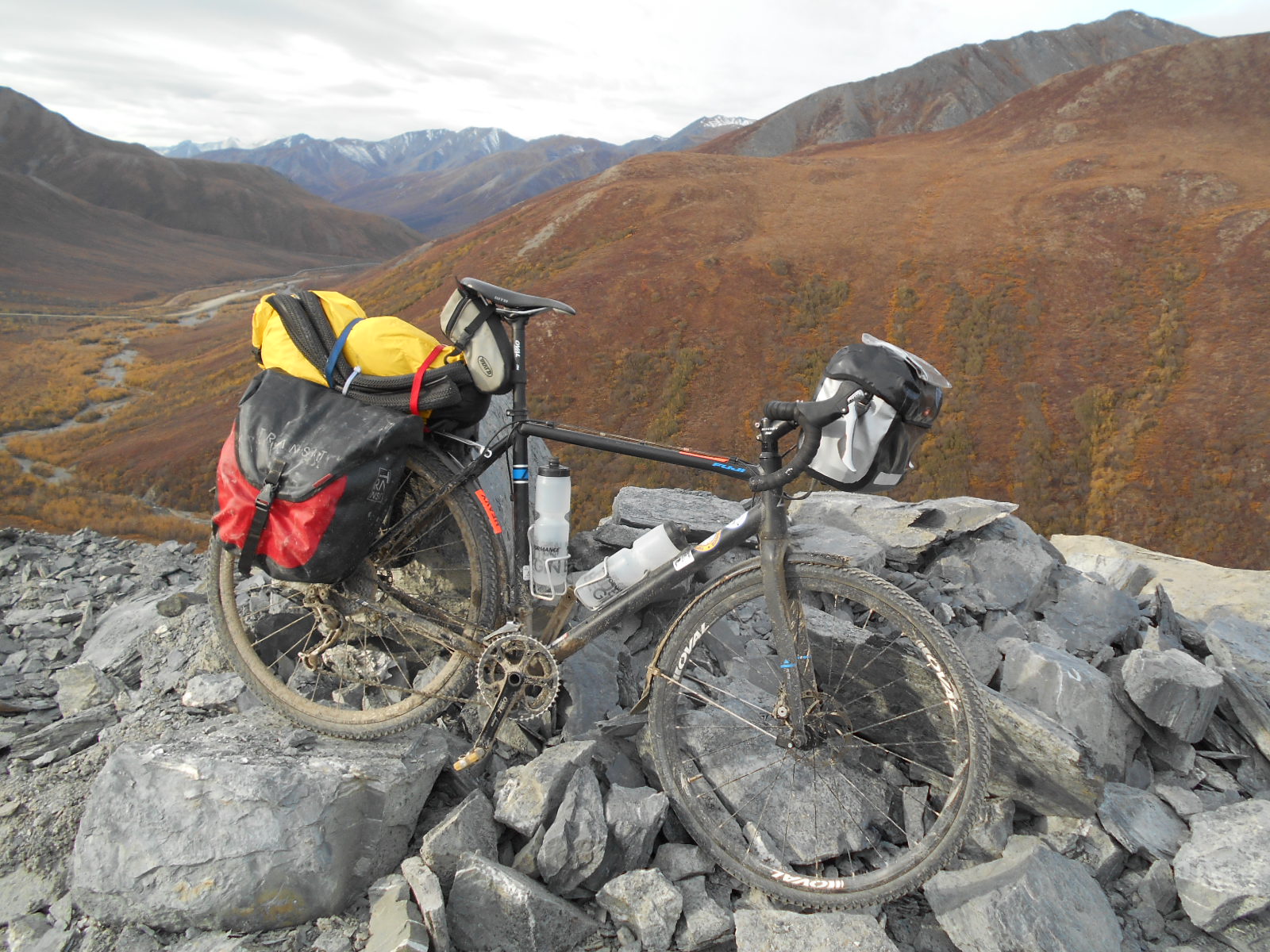
Choice of bicycle is up to you. My earlier post on "The Bicycle" covers this subject. Just make sure you have super low gears for the hills and fat tires for the mud and gravel!

Lodging in Deadhorse is $160 per night at the Prudhoe Bay hotel, but includes unlimited meals and snacks at the workers' cafeteria. A room at the Coldfoot truck stop is $160 with meals extra. Typical Fairbanks lodging is $160-$180 per night during the summer tourist season. Fairbanks' campgrounds charge $25 for a single tent, but they close around Sept 1 for the winter.

No rental car company in Alaska will rent you a car or RV for use on the gravel Dalton Highway.

Pistols cannot be purchased by out of state residents, so you will have to bring your own or borrow one. Unloaded pistols (in locked case) and ammo can be shipped (separately from gun) inside your luggage to Alaska. Bear spray and air horns available everywhere in Fairbanks.

Fairbanks is the logistical hub/resupply center for the interior and arctic Alaska. There are major grocery stores and big box retailers in town. Prices are reasonable. Beaver Sports is a great outdoor gear/bike shop if you need camping or bike supplies. REI is also in town now. Goldstream Sports, on the edge of town, is the headquarters for hardcore cyclists/triathletes/nordic skiers.

You can fly and ship your bike via Alaska Airlines and Ravn Air to Deadhorse Airport. Prudhoe Bay Hotel is right across the street from the terminal.

There is no cell service for nearly 500 miles! Only two truck stops for 500 miles! Resupply can to mailed to the Coldfoot Camp post office (open just 3 afternoons a week). Be self-sufficient and enjoy this amazing and challenging wilderness bike ride!


A link to the BLM guide for cyclists doing the Dalton Highway: 
https://www.alaskageographic.org/uploads/pdf/dalton-vg2014-web.pdf 


Furballs and Firearms

Several folks have asked me about the pistol they have seen in my photographs, and why it was needed? It is a bit difficult to explain this to folks who have not spent much time in the Alaskan bush. To an Alaskan having a firearm is quite normal, even expected.  Alaska is a huge area with few roads and towns. Wildlife truly abounds here. They are a special part of the Alaskan experience. One routinely sees bears, wolves, moose, caribou. In an area 2 1/2 times the size of Texas, spanning 1,480 miles by 810 miles, one is always in Nature's backyard.
Bear encounters are routine in Alaska. In fact, at my field project this summer, we had encounters on a near daily basis for a month. Air horns generally scare them off and all personnel carry pepper spray.  Scientists, Fish and Game personnel and geologists routinely carry a firearm in the field. I personally know a geologist that was severely mauled by a grizzly bear in 2010. I have also met another geologist that nearly lost his life in a bear attack.

Paranoia about bear attacks is not useful. Proper precautions with food handling, food storage and bear awareness in brushy areas is all that is normally needed. Pepper spray is very effective. In one study of 176 encounters where bear spray was used, only three people had injuries; and those injured only had scratches with no fatalities to humans or the bears.

Now a can of pepper spray is not as assuring as packing a big 'ole gun on one's hip, that's for sure! So most Alaskans carry a magnum-sized caliber pistol, assuming they don't already have a shotgun with slugs along too. Shotguns are the first choice,  though not as convenient nor handy while working in the brush. Statistically firearms are not a better choice than bear spray. In 269 close-quarter encounters using a firearm, 151 people were still injured (some killed) by the bear and 172 bears killed. Handguns actually were slightly better at stopping the the bear's aggression than rifles, 84 versus 76.

So if handguns are less effective than bear spray, why did I find myself pedaling along with a massive .44 magnum pistol in my handlebar bag? Was this some Clint Eastwood "Dirty Harry" fantasy on my part?! Wolves, that is why.

These photos were taken from the inside of my work truck just 10 days before I started my bike ride. These three wolves were totally unafraid and surrounded my truck. The two projects I have worked in the Brooks Range have both had very active wolf packs in the area. At both locations wolves came through camp routinely. At camp closing day, 3 days before my ride, there were two wolves spotted down at our dirt airstrip. A single can of bear spray would not fend off several wolves intent on getting you. In some historical accounts people have been killed by large packs, even while armed. In one incident the remains of the person was surrounded by 16 wolves he had killed in defense before dying himself. A coworker of mine has seen a massive pack of nearly 60 wolves near our unoccupied project camp in winter, during an aerial reconnaissance.

A few selected wolf encounters:

2006 A wolf chases a bicyclist down the Dalton Highway; before being run over by a trucker, saving the cyclist
2006 A wolf bit a woman near the Arctic Circle on the Dalton Highway
2006 A group of bus tourists were approached by a wolf on the Dalton Highway
2006 Motorcyclist was chased by a wolf on Dalton Highway
2010 Jogger killed by two wolves in Alaska
2012 Snowmobile rider attacked by wolf in Alaska
2013 In two separate incidents cyclists were attacked by wolves and rescued by motorists in Canada
2014 Female snowshoe hiker and her 4 dogs attacked by lone wolf in Alaska

This is not a rant about how we ought to be exterminating wolves, especially in the western USA. I find wolves and bears an interesting and necessary part of the ecosystem. Just be prepared if you go into their backyard...

For the touring cyclist or backpacker in Alaska,  I'd recommend a lightweight handgun with 2 clips of ammo for wolf protection. Also bring along a small air horn and bear spray for the bears. You'll sleep well at night then!

Tuesday, October 6, 2015

Fairbanks or Bust!

I was now within striking distance of Fairbanks. It was 74 miles to Fox and another 10 miles to Fairbanks. I could taste the cold beer on my lips now! My sleeping bag was wet once again and I was determined to make it to Fairbanks today, come hell or high water. What I didn't expect were even more extreme hills, more mud, plus freezing rain and snow. It seems nature was really trying to crush me. After 9 days of cycling, with only 2 months of exercise bike training under my belt, I dug about as deep into myself as I ever had before to complete my ride. Endless grades, under wet gloomy clouds, almost crushed my spirits. My feet were so numb from the wet slush that often I'd stop and walk to get the circulation flowing again. This in spite of wearing a polyester liner sock, a thick wool sock and neoprene cycling booties! My hands were frozen and useless, my Windstopper gloves totally soaked. Several times I'd have to stop and wring out all the icy water from my gloves.

 VIDEO LINK


For nearly 20 miles I battled and clawed my way through slush and steep grades. I had a long terrifying descent down Wickersam Dome, in slush and thick fog. Definitely one of those "must not fall" situations. My rear brake was frozen open and unusable, plus the road surface was too slick to use my front brake. At high speed, on the edge of control, I sped down the mountain.


Near dusk I reach Fox and the welcoming lights of the the Silver Gulch Brewery. This was it, end of the ride. I was frozen top to bottom, there would be no more cycling into Fairbanks 10 miles away. Dripping wet I went inside and stripped off wet layers in the restroom. The rain pounded outside and darkness fell. I drank deeply of my first beer in 9 days. It had been a challenging ride and today was beyond category. Fox was enough, as I had cycled here many times before from Fairbanks. The link complete. Nearly 500 miles accomplished under trying conditions. That was something to be proud of. I was ready to go home now, finally.

Hill Country Hell

Saying adieu to the Yukon River, I pedaled away in rain and cold 40 degree temperatures. The road was muddy, but not the same super-sticky variety of yesterday. The hills were a major challenge. So far I hadn't had to walk or push my bike for 350 miles. Today's hills would crush that record and my ego. Six different times I'd have to dismount and push my heavily-ladened bike up another muddy hill. This was like the hills of Kentucky, straight up and then straight down. Unnamed grades, repeating themselves over and over.
 VIDEO LINK

Often I'd go through vast areas of old burns too. Alaska is too big to economically put out forest fires, so they spread until autumn rains and winter snows extinguish them. Mid-summer Alaska is often quite smokey due to these fires. At least I didn't have that to contend with too!

Fairbanks had had lots of smoke this summer, pity the visitors doing their big Alaska adventure vacation. A photo from this summer's Fairbanks newspaper.
After a super hilly day I finally reached the Elliot Highway. The 414 mile Dalton Highway had been conquered, well,  more like endured. I was psyched to reach this goal. The road junction signs were plastered with stickers and memorabilia from cyclists and motorcyclist who had passed this way. The goal to ride from the Arctic to Tierra del Fuego, at the tip of South America, is a "bucket list" goal for a few crazy souls. I enjoyed looking at the stickers and marveled at the adventures of the individuals they represented.

VIDEO LINK


I spun down a side road and set my tent up for the night, dreams of Patagonia in my mind.

Mud Baptism

The rain was pounding on my tent, Arctic Circle rain. The inside of my tent sagged low with water drops, soaking parts of my sleeping bag. In the semi-dawn I debated, would this be a rest day or not? In six days I hadn't taken a break at all. My knees were creaking from the effort and my thighs laced with lactic acid. A break would be nice, perhaps even needed. But could I stand a tent-bound day, while my sleeping bag got wetter and wetter?

I went outside the tent for a peek. Low grey clouds raced past the tree tops, but sort of a quartering tailwind. That was enough to have me eat a quick breakfast and roll my tent up in the rain. It was a soggy mess when I put it in it's stuff sack. The Yukon was 65 miles away, but a truck stop there was supposed to be open until the end of October. Perhaps another chance to dry out my gear? In wet conditions I cycled onto the very muddy road.

All day long I had to battle with the mug clogging my chain, gears and derailleurs. My chain started to hop erratically with the mud and rocks in it. At times only a couple gears would work properly. Even my fenders began to clog up with mud. I seemed the closer I got to the Yukon River the stickier the mud got.


Most cyclist I know are sort of gear heads. Any dirt they get on their bike they clean off immediately after a ride. A fastidious and a bit tech nerdy crowd. Any thoughts of cleaning my chain would have been ludicrous, as it would have been totally mud-clad within minutes again. With grit and grim "lubricating" the poor chain I soldiered on, having my own personal trench warfare experience.
I was nearly at my wits end when finally the Yukon River bridge appeared. The day's ride had been super hilly and the mud exasperating. Within sight of the bridge I ground to a halt, my fenders so clogged with mud that I had to once again clear with my tire iron. Shifting was impossible, I only had one usable gear!

VIDEO LINK

The Yukon River Camp was packed with caribou hunter trucks and boats. As only one of two places in Alaska that the Yukon River is accessible by road, hunters trailer boats there to gain access to remote hunting areas up or downriver. There were easily 100 trucks parked there.


Once in the cafe, finally out of the rain and mud, I regained my psyche. I grabbed a corner booth and unpacked my wet sleeping bag to dry out. I chatted with some truckers and a friendly waitress. As we chatted, it seems that after this job she was headed to the Dominican Republic to work for the Peace Corp. Another interesting personal connection along this road, as I had sailed there by sailboat from Florida within the past year.  So many "coincidences", the world is smaller than one thinks, that's for sure.

The truckers reported that the mud ahead was supposed to not be as bad, but I'd have even more hills to battle. The forecast was for continued rain, ugh!

With no cell coverage to phone home, I begged to use the cafe's office computer to send a quick email home to check-in. The waitress was helpful and let me. After eating dinner, I dunked my bike into the Yukon River to cleanse it of the mud. In light rain, I found a nice grassy spot on the banks of the river to pitch my tent, still as wet on the inside as outside. I'd have to dry my sleeping bag in the morning again before pedaling off.


Monday, October 5, 2015

Arctic Circle or Bust!

After a night in the rain, I rolled up my tent and got breakfast at the Coldfoot Camp cafe. I drug in my damp sleeping bag and grabbed a booth by the heater. After chatting some more with the Chilean motorcyclist, I pedaled off into the rain aiming for the Arctic Circle.
 For awhile the pedaling was easy, still going downhill. There were fall colors everywhere. Although lightly drizzling, I made good time and was in good spirits.
I came upon a float plane left temporarily by caribou hunters. Want to trade?!
Finally my luck seemed to run out. A real bitch of a grade faced me, climbing for several miles up to a summit innocuously named "Gobblers Knob".  Strangely it was paved for awhile, way out here in the middle of nowhere. At the summit a sign said I had pedaled past Prospect Creek, formerly the location of the coldest temp recorded in North America. No winter pedaling here that's for sure.

The cycling was now across broad valleys and then up steep hills. It was progressively getting tougher. However there were lots of pretty views and streams for filling my water bottle. A bit cool and grey, but I was psyched to reached the Arctic Circle shortly!


Pulling into the Arctic Circle parking lot, I met a group of about eight Chinese-Americans posing with the sign. It turned out one was from Lyons, Colorado, just down the road from home. A helpful BLM Ranger took my photo. She was from Oregon, up for ten days, covering for a vacationing local ranger. She was definitely glad to be escaping all the Oregon fires and smoke.


I chose to not camp at the really nice looking BLM sites at the Arctic Circle. The Arctic Circle sites are on a hill, exposed to the wind and lack water. Dropping down the highway to the nearby Fish Creek, I found a nice comfy and sheltered spot for the night.


Halfway!

I was surprised to see some grey clouds when I awoke on the banks of the Koyukuk River. At 2am I had a 'nature call' and was blessed with a starry sky laced with green Northern Lights. Now grey skies were building. I got rolling promptly, determined to reach Coldfoot Camp, the truck stop marking the halfway point of my journey. I couldn't resist one more photo of the massive marble Sukakak mountain before pedaling off. It looked like an Dolomite mountain transplanted from Italy.


The cycling went fast and easy, mostly flat. By 11:30 am I reached Coldfoot in increasingly wet conditions. I didn't care, I was halfway and ready for a big trucker-style lunch! I first paid for a shower ($14) and then threw my stinky clothes in the washer and dryer. For most of the afternoon I hung out, sipping coffee and trying to get wifi Internet access. No cell service here. The rain pounded the muddy parking lot outside.


Near dark, I accepted my fate and pitched my tent in the rain across the parking lot. Getting a room for the night would have cost me $160, so even my soggy tent looked inviting! I went back into the cafe for a last coffee and met a just arrived Chilean fellow who was trying to ride to Prudhoe Bay by motorcycle. He has been turned around by snow about 40 miles away and was now heading south. He mentioned that two vehicles with caribou hunters had also turned around. It seems that in spite of the snowy conditions I went over Atigun Pass, things had gotten much worse. I may have been the last person on two wheels (motorized or not) to get through for the season. I had been pretty lucky.

Sunday, October 4, 2015

Atigun Pass

Surprise!!

VIDEO LINK

Whoa, a frosty start to my big day of climbing Atigun Pass. Surprisingly I wasn't bummed at all by finding snow this morning. In fact it just added to the adventure of climbing over the Brooks Range's highest pass at 4,739', with it's 12% grades. In fact this is Alaska's highest year-round highway pass. A major challenge for the truckers supplying Prudhoe Bay, it normally means a push-a-thon by cyclists trying to cross it.

While I was packing up my icy tent, a hunter stopped his camper and brought me over some Starbucks coffee he had brewed. An angel in camo! We had a short chat and then he was off to look for caribou. A kind fellow and it reminded me of the corny "Hug a Hunter" ads being run on TV. I definitely could have hugged him!
 With a belly full of warm coffee and a recharged spirit I charged off for Atigun Pass. Tires slipping on the snowy road, I pedaled for all I was worth up that Pass. I needed to tack back and forth across the roadway, as the grade was so great. I pedaled the whole way up, out of the saddle, putting my full body weight into the cranks. Finally I topped out in dense clouds, tired but really pleased that I hadn't walked up it at all. Yeah!


The descent down the south side of Atigun Pass was a screamer, with a dangerous layer of  loose gravel. I seriously doubted my chances with the narrow 38mm tires on my bike. Even with sparing use the the disk brakes, I could smell them smoking a bit. Like a runaway train I was totally committed. I raced downwards, with the fully weight of touring bags pushing me to my doom. This was one of those times one thinks about the consequences of a potential crash. The nearest clinic was 150 miles to the north in Prudhoe Bay and Fairbanks hospital 350 miles to the south, and with no ambulances in between. I kept telling myself to stay cool and calm, as the gravel flew beneath my wheels. Yikes!

VIDEO LINK


Finally the grade moderated and  I could stop and catch my breath. That had been a pretty "out there" descent. I now noticed that the clouds were thinning out to the south. It looked like Atigun Pass was acting as a sentinel, keeping the northern storm from crossing. So I enjoyed mile upon mile of downhill riding, with the weather improving with each pedal revolution.


I noticed that there was more fall colors now. The northern tundra had been quite brown, the autumn season advanced already,  even in early September. But now hints of color were showing. And then I came around a bend and my first pine trees appeared! A road sign was placed there and said these this was the northernmost treeline. In fact this was equivalent to being at 12,000' in Colorado, the same vegetation zone. Pedaling off, I soon noticed more and more trees and color in the brush. It was sort of exciting viewing, given the sterile tundra I had just been in.

The mountains soon grew larger with wild rivers and peaks for mountaineers!


I had seen a mileage sigh for Dietrich, which turned out to be just a gated dirt road for an abandoned road construction camp from the 1970's. However there was one friendly resident. I'll call him "Dietrich", a friendly bird. He eagerly greeted me, seemingly well-versed on how to beg for my food. He took as much granola as I'd give him. Winter was coming and I was his grocery store!

By late afternoon I arrived at the banks of the Koyukuk River. A beautiful spot which made a great ending for a great day. Atigun Pass had been crossed in demanding conditions, yet in good style. As I set up my camp I meet some motorists from North Dakota. I invited them over to share this idyllic camp spot on the river. We were having a friendly chat when we discovered that my wife worked for the same company back home as his nephew did, and worked just down the hall from her! Crazy coincident. They offered me some pizza and beer and we enjoyed a campfire (my first) together. At 2am the northern lights danced above. Magic!